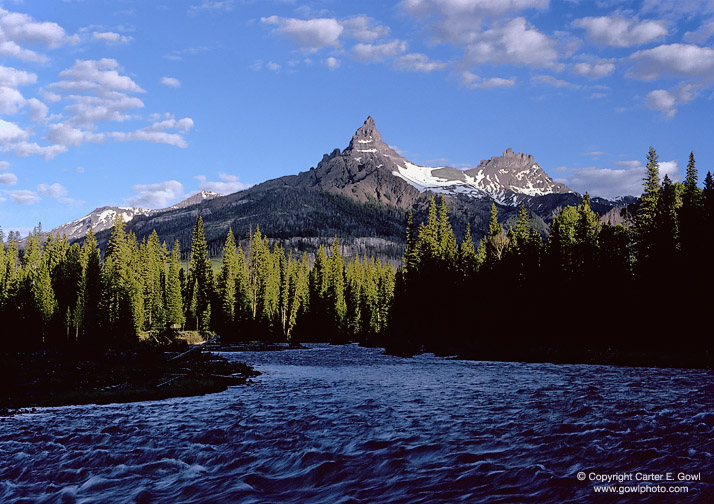
PILOT & INDEX PEAKS
ABSAROKA RANGE, WYOMING
ABSAROKA RANGE, WYOMING
| Morning view toward the west — along the Clarks Fork of the Yellowstone River. Pilot Peak, the classic glacier carved horn peak, is 11,708 ft. elevation. In about 1930 the names of these two peaks were reversed, perhaps due to a mapping error. Prior to the turn of the century, the erstwhile Pilot Peak (now known as Index and to the right in the photograph) was known as Dog Turd Peak — a name bestowed by the local miners. The refusal of the U.S. Geological Survey to use this name when the first maps of the area were published resulted in the adoption of the name Pilot Peak. |
Please refer to code P8 when making inquiries.
© Copyright Carter E. Gowl
www.gowlphoto.com
www.gowlphoto.com
• About | Contact | Prints | Gallery I | Gallery II | Gallery III | Gallery IV | Gallery V | Gallery VI | Gallery VII •
Website
and all images © Copyright Carter E. Gowl, no use without permission.
www.gowlphoto.com